


Booklet titled `Isle of Tiree` edited by Mona MacDonald, with photocopy.
Guide to townships on Tiree, local advertising and map. Accession includes photocopy of same.

Booklet titled `Isle of Tiree` edited by Mona MacDonald, with photocopy.
Guide to townships on Tiree, local advertising and map. Accession includes photocopy of same.
Ordnance Survey map, sheet NL94SE, 1:10,000.
Map of Moss, Barrapol, Heylipol, Balephuil, Mannal, Balemartine, Balinoe and Crossapol showing contour lines, roads and paths, boundaries, townships and buildings, bridges and cattle grids, rivers and drains, sites of antiquities, vegetation and rock features.
Ordnance Survey map sheet LXVIII.
Map of the south-west area of Tiree at a scale of 6 inches to the mile (1:10,560).
Laser print of colour photograph of Malcolm and Mary MacDonald of Mannal.
Building a haystack in Mannal in the 1950s. L-R: Malcom MacDonald (Calum Ruadh) and his wife Mary, nee MacLean. (Mary is an aunt of Annette MacKinnon, Crossapol)
Postcard of Mannal
Postcard of Mannal taken from Am Meall, postmarked 1950. Labelled “Balemartine”.

Black and white photograph of Mannal.
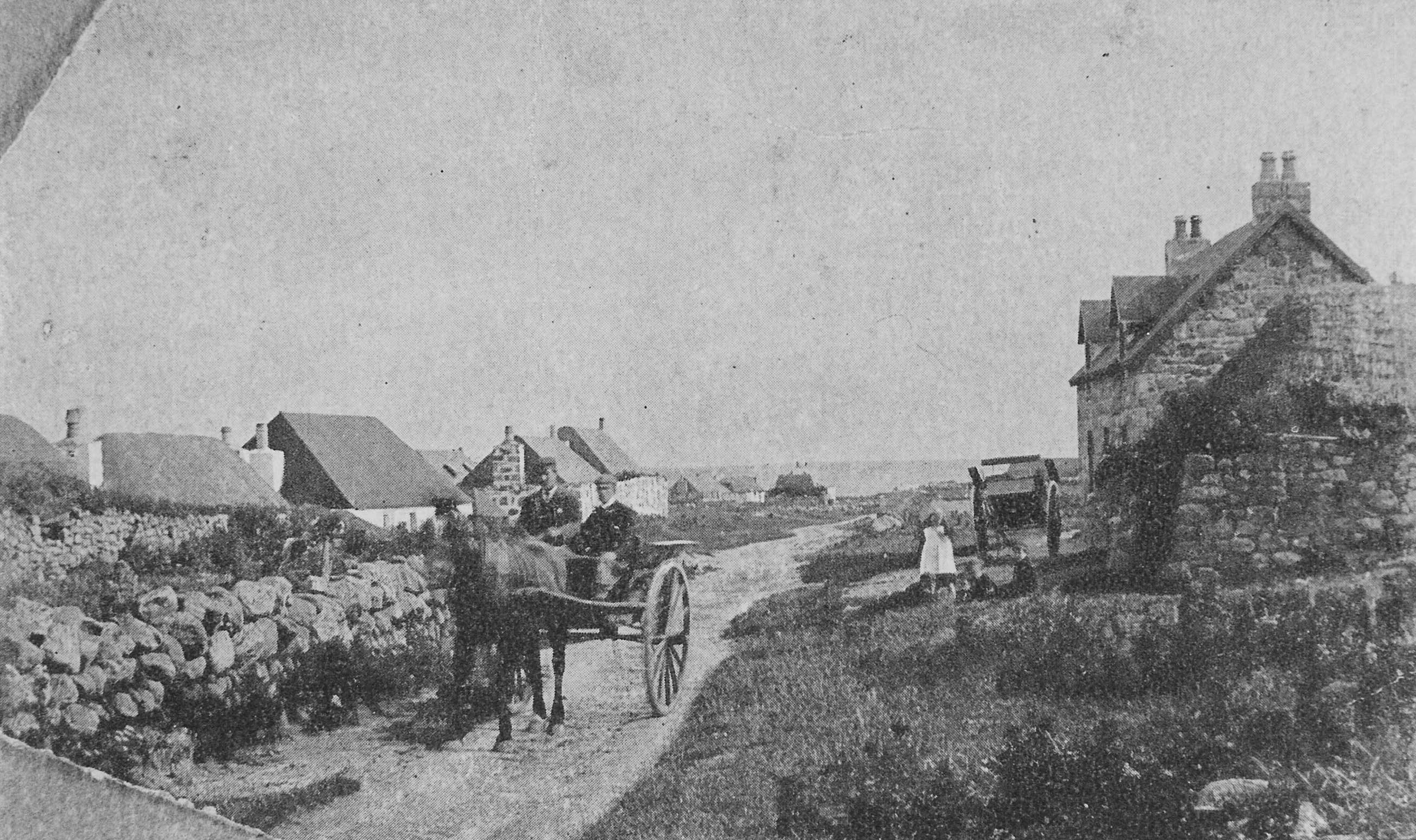
View of Mannal looking south with two men in a horse-drawn cart and children playing at the side of the road. (Original photograph 1997.178.1)
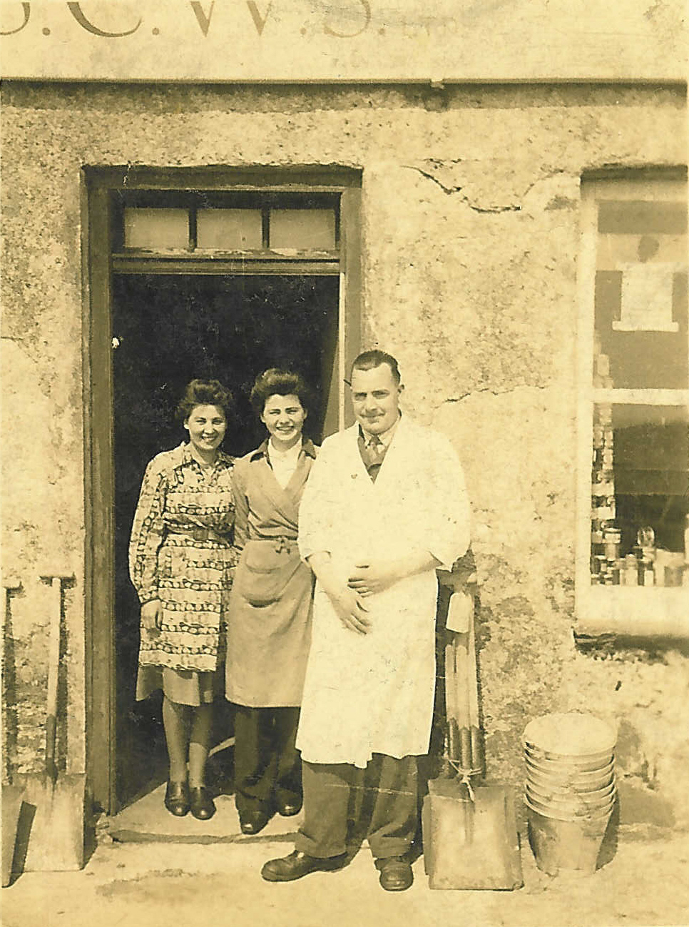
Black and white photograph of the Co-op staff taken in 1942.
The Co-operative Store, 1942. L-R: Flora MacKinnon, Cornaigmore (mother of Fiona MacLeod, Kilmoluaig); Effie Wheeley nee MacDonald, Mannal; manager Mr Robb.
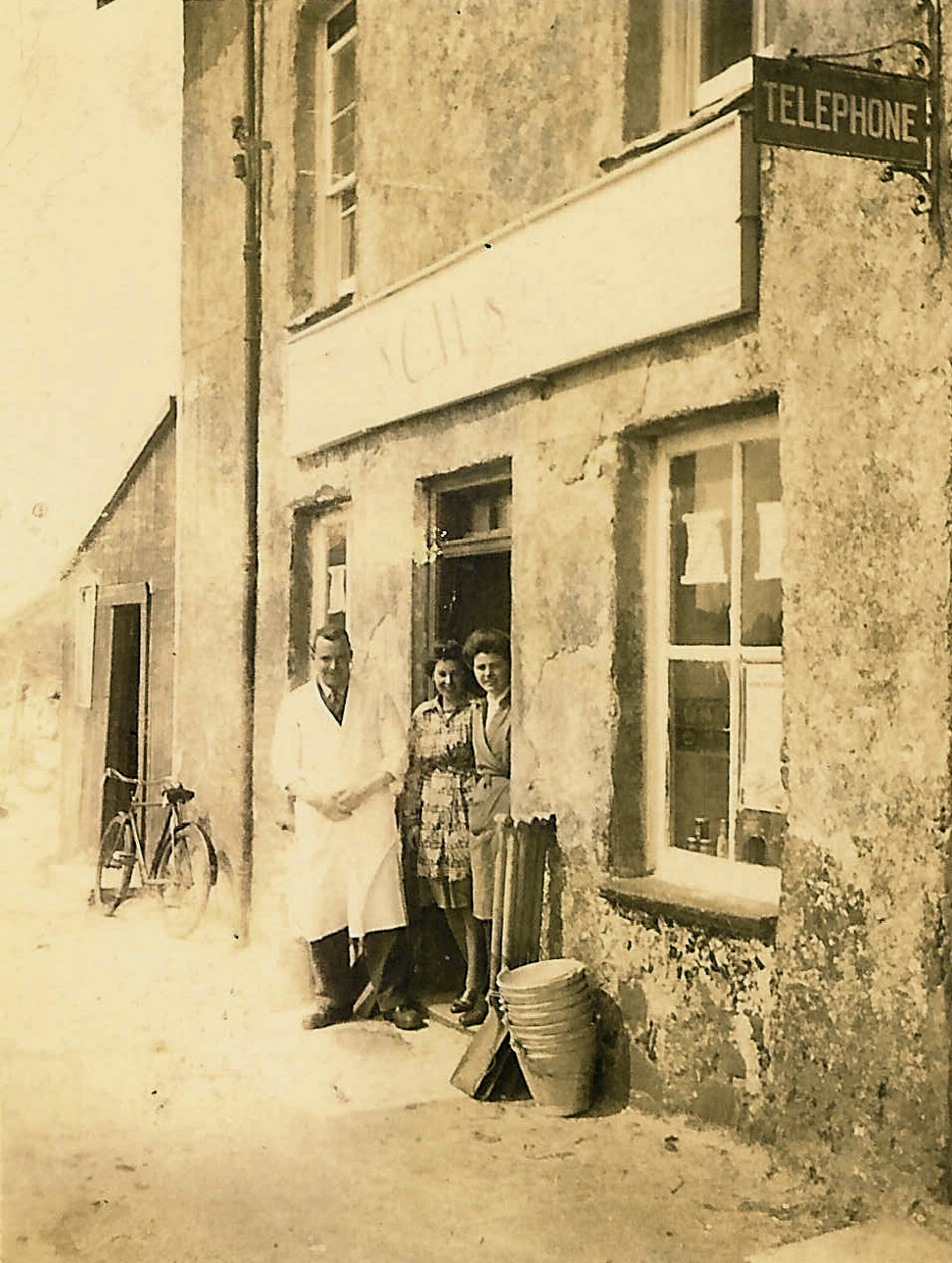
Black and white photograph of the Co-op staff taken in 1942.
The Co-operative Store, Scarinish in 1942. L-R: manager Mr Robb; Flora MacKinnon, Cornaigmore (mother of Fiona MacLeod, Kilmoluaig); Effie Wheeley nee MacDonald, Mannal.
Photocopied book extract `List of Inhabitants of Tyree and their Age in September 1779` edited by Eric Cregeen.
The inhabitants listed by township and family.
Click here to view extract 1997.54.1 Cornaigmore
Petition from Poor Persons in Tyree for Aid to Emigrate
Transcription of a petition for assistance to emigrate appended to ‘Crofts and Farms in the Hebrides’ by the 8th Duke of Argyll.
This petition was sent in 1851 to Sir John MacNeill, Chairman of the Board of Supervisors for the Relief of the Poor in Scotland. Sir John was married to a daughter of the 8th Duke of Argyll, who appended the petition to his ‘Crofts and Farms in Hebrides’ addressed to the Napier Commission of 1883.
A hundred and thirty-six islanders signed the petition. Ninety-nine of them were landless cottars; the remainder were small tenants, of whom only four paid rent over £10 a year. They represented the class of islanders that the Duke was anxious to clear from his estate.
Around a third of the petitioners were given assistance to emigrate with their families on board the ‘Conrad’, ‘Birman’ and ‘Onyx’ in July 1851. Another twenty-seven families from the island left with them.
