Ordnance Survey map, 2nd edition, sheet LXXVIII.9, 1:2,500.
Map of Ceann a` Bhara with Gaelic place-names added in pencil by Dr John Holliday at a scale of 1:2,500.

Ordnance Survey map, 2nd edition, sheet LXXVIII.9, 1:2,500.
Map of Ceann a` Bhara with Gaelic place-names added in pencil by Dr John Holliday at a scale of 1:2,500.
Ordnance Survey map, sheet NL94SW, 1:10,000.
Map of Kilkenneth, Greenhill, Sandaig, Middleton, Barrapol and Ceann a` Bhara showing contour lines, roads and paths, boundaries, townships and buildings, bridges and cattle grids, rivers and drains, sites of antiquities, vegetation and rock features.
Twenty-two photographs of Tiree from RCAHMS, 1900-1977
.
Ordnance Survey map sheet LXXVIII.
Map of the south-west area of Tiree at a scale of 6 inches to the mile (1:10,560).
Ordnance Survey map sheet LXVIII.
Map of the south-west area of Tiree at a scale of 6 inches to the mile (1:10,560).
Black and white postcard of St Patrick`s chapel.
St Patrick`s chapel, Kennavara, showing gable end.

Black and white postcard with different views of Tiree.
Postcard showing the M.V `Claymore` and views of Gott Bay, the Ringing Stone, Kenevara and Scarinish

Postcard of Travee Bay.
Traigh Bhi with Kennavara in the distance.

Postcard of Balephetrish.
View from Balephetrish hill looking towards Kennavara and Ben Hough.

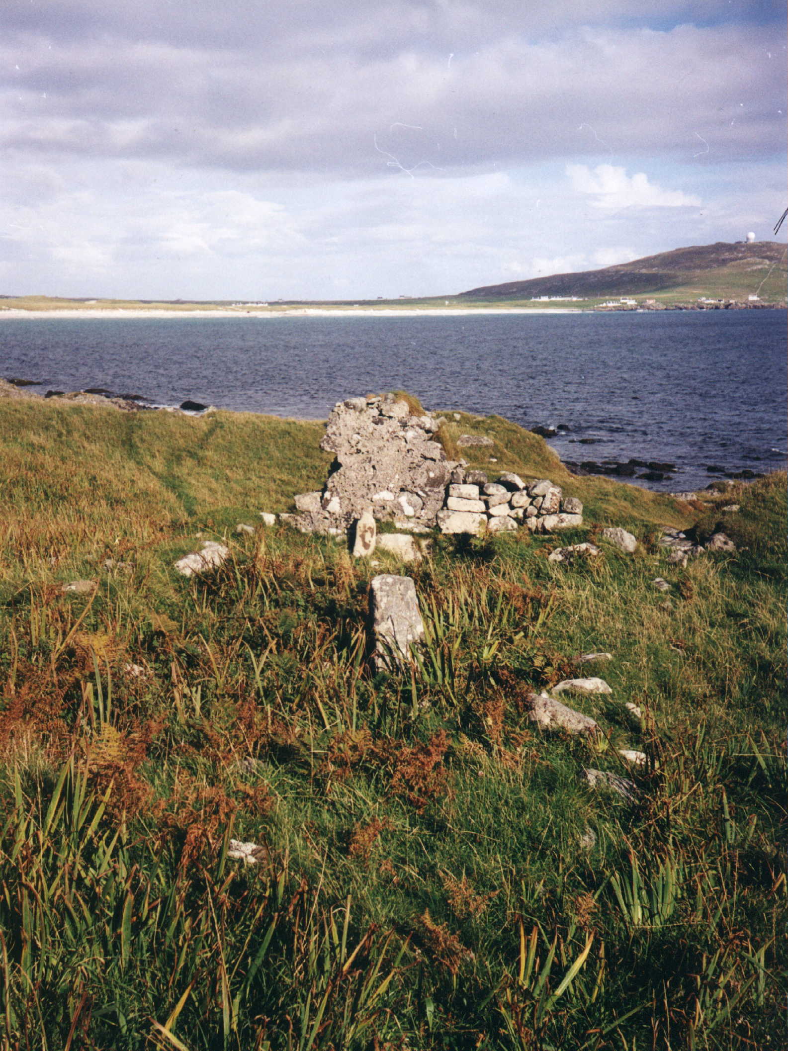
Colour photograph of St Patrick`s Chapel, Kennavara.
St Patrick`s Chapel, Kennavara.