


Black and white photograph of Taigh Alasdair in Baugh.
Taigh Alasdair in Baugh, photographed by Morton Boyd in the 1940s or 1950s.

Black and white photograph of Taigh Alasdair in Baugh.
Taigh Alasdair in Baugh, photographed by Morton Boyd in the 1940s or 1950s.
Black and white photograph of Taigh Alasdair in Baugh.
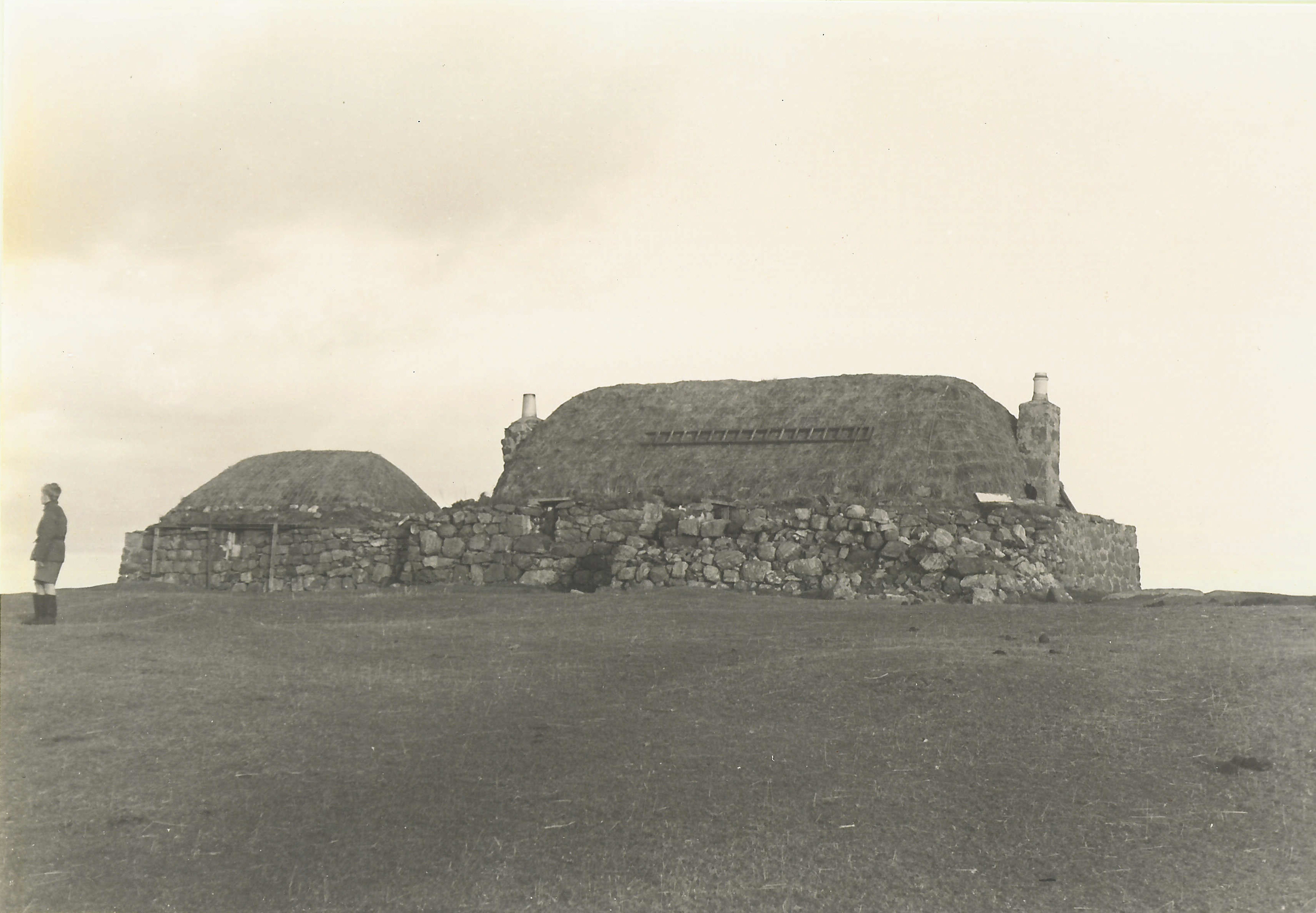
Taigh Alasdair and the stackyard in Baugh, photographed by Morton Boyd in the 1940s or 1950s.

Audio cassette recording of Alasdair Sinclair of Greenhill, Hugh MacLean of Barrapol and Hector MacPhail of Ruaig recorded by Dr John Holliday on 9/11/1995.
Angus and Hugh MacLean, Hector MacPhail, Alasdair Sinclair and Dr John Holliday ceilidh in Greenhill in November 1995 and discuss the genealogy of the MacLeans of Rossdhu, Cornaig and Middleton and the MacDonalds of Kilmoluaig, the poems of William MacPhail of Croish and of John MacDonald of Heanish, the genealogy of the MacKinnons of Odhnasgair (Orisgeal), fiddler and clarsach player Kate Orisgeal; Hector and Hugh tell sea-faring stories and Alasdair quotes numerous riddles. Tha Aonghas agus Eòghann MhicIllEathain, Eachann MhicPhàil, Alasdair Mac na Cearda agus an Dotair Iain Holliday air chèilidh ann an Grianail anns an t-Samhain 1995, a’ rannsachaidh sloinnearachd muinntir MhicIllEathain a Rossdhu, Còrnaig agus am Baile Meadhanach agus na Dòmhnallaich a Cill Moluaig, òrain Uilleam Mhic Phàil as a’ Chrois agus Iain Dòmhnallach a Hianais, sloinntearachd clann MhicFhionghain a Odhrasgair, Ceit Odhrasgair, cluicheadair fidheall agus clàrsach; tha Eachann agus Eòghann ag innse sgeulachdan fairge agus Alasdair a’ cur iomadach toimhseachan orra.
Black and white postcard of Baugh.
View of Baugh.

Booklet titled `Isle of Tiree` edited by Mona MacDonald, with photocopy.
Guide to townships on Tiree, local advertising and map. Accession includes photocopy of same.
Ordnance Survey map, sheet NL04SW, 1:10,000.
Map of the Reef, Baugh, Heanish and Scarinish showing contour lines, roads and paths, boundaries, townships and buildings, bridges and cattle grids, rivers and drains, sites of antiquities, vegetation and rock features.
Map of part of Tiree showing the mains water supply in 1977.
Map showing the continuation of Phase II of the Tiree Rural Water Supply for Cornaig, Balephetrish, Gott, Kirkapol, Scarinish, Baugh, the Reef, Crossapol, Kenovay, Kilmoluaig and Balevullin, at a scale of 1:56,000 dated 1977.
Colour photograph of the surgery car park in the snow in December 2000.
The surgery car park in the snow in December 2000.
Colour photograph of Baugh in the snow in December 2000.
Snow from the snowploughs at the side of the road at Baugh with the surgery in the background taken in December 2000.
Ordnance Survey map sheet LXV.13 & 14 .
Map of the Baugh, Heanish and Scarinish areas at a scale of 25 inches to the mile (1:2,500).