Digitised outline copy of the Plan of Kenovay, Tyree, as divided by George Langlands, 1802. The township is divided into thirteen plots of 25-39 acres, each with access to a common watering place near/at Lochan Dow. A croft of 5.1 acres for the Reef Keeper is also laid out. The line of a ‘new march dike between the Reef and Kenovay’ and the ‘old march dike’ with Cornaigbeg Lands are also depicted.
From the archives of the Dukes of Argyll at Inveraray Castle, made available through the Written in the Landscape project.
Digitised outline copy of the Plan of Ballimartin, Tyree, as divided into crofts by George Langlands, 1802. The township is divided into 38 crofts of 4-5 acres each, laid out in a grid pattern, with two areas of common cow pasture and one area of common horse pasture. Total acreages given. The location of a burial place is shown near the march with Ballino Lands.
From the archives of the Dukes of Argyll at Inveraray Castle, made available through the Written in the Landscape project.
Digitised copy of a map of Tiree showing townships and numbers of tenants in 1848. The map appears to show all townships, but not all have tenant numbers attached. Geographical features are also named (bays, lochs, harbours, moss, ‘the reef or great green plan’).
From the archives of the Dukes of Argyll at Inveraray Castle, made available through the Written in the Landscape project.
Digitised copy of a marine and landscape map of Tiree. The landscape is depicted in detail, including crofts, field boundaries, schools, churches, mills, shops, smithies, fanks, quarries, stores, kelp sheds, Middleton Chemical Works, ruins, standing stones, pasture, blown sand, raised beaches. No surveyor is listed.
From the archives of the Dukes of Argyll at Inveraray Castle, made available through the Written in the Landscape project.
Digitised copy of James Turnbull’s Survey of Tiree, titled ‘Plan of the Island of Tiree in Argyleshire the Property of His Grace The Duke of Argyll. Surveyed and Plan’d Anno 1768/9 by James Turnbull’. The map depicts the Tiree landscape before the modern crofting landscape was created in the nineteenth century, showing clusters of large farming townships separated by rigs of infield and outfield cultivation, common grazing, ‘old danish forts’ and other antiquities.
From the archives of the Dukes of Argyll at Inveraray Castle, made available through the Written in the Landscape project.
Two CD-ROMs containing texts by Neil M Brownlie, Barrapol (1925-2015): (1) Three MacLean Bards from Tiree (143 pages), and (2) The Etymology of the Place-names in Tiree (358 pages).
Pages photocopied from the ‘Scottish Baptist Magazine’, ca 1910-1930, with obituaries for two Baptist ministers who were born and raised on Tiree: Rev. Duncan MacFarlane (1822-1908), and Rev. Alexander MacArthur (1900-1930).
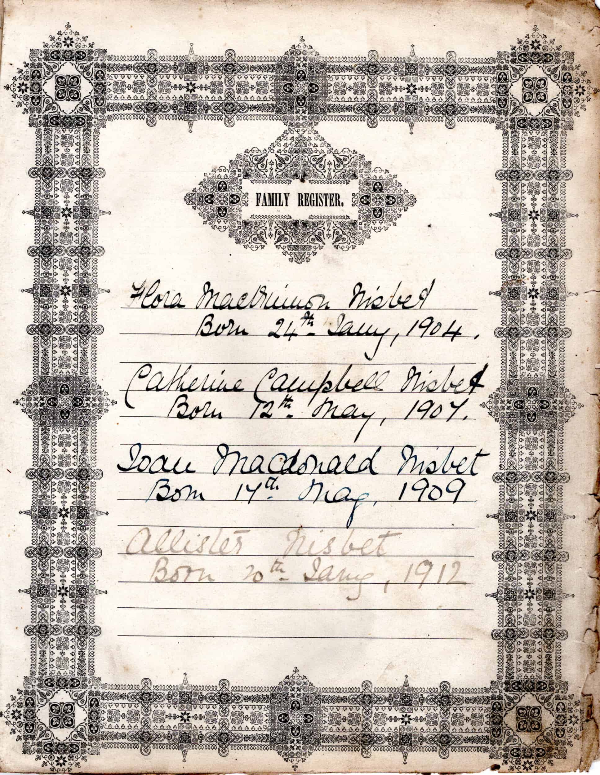
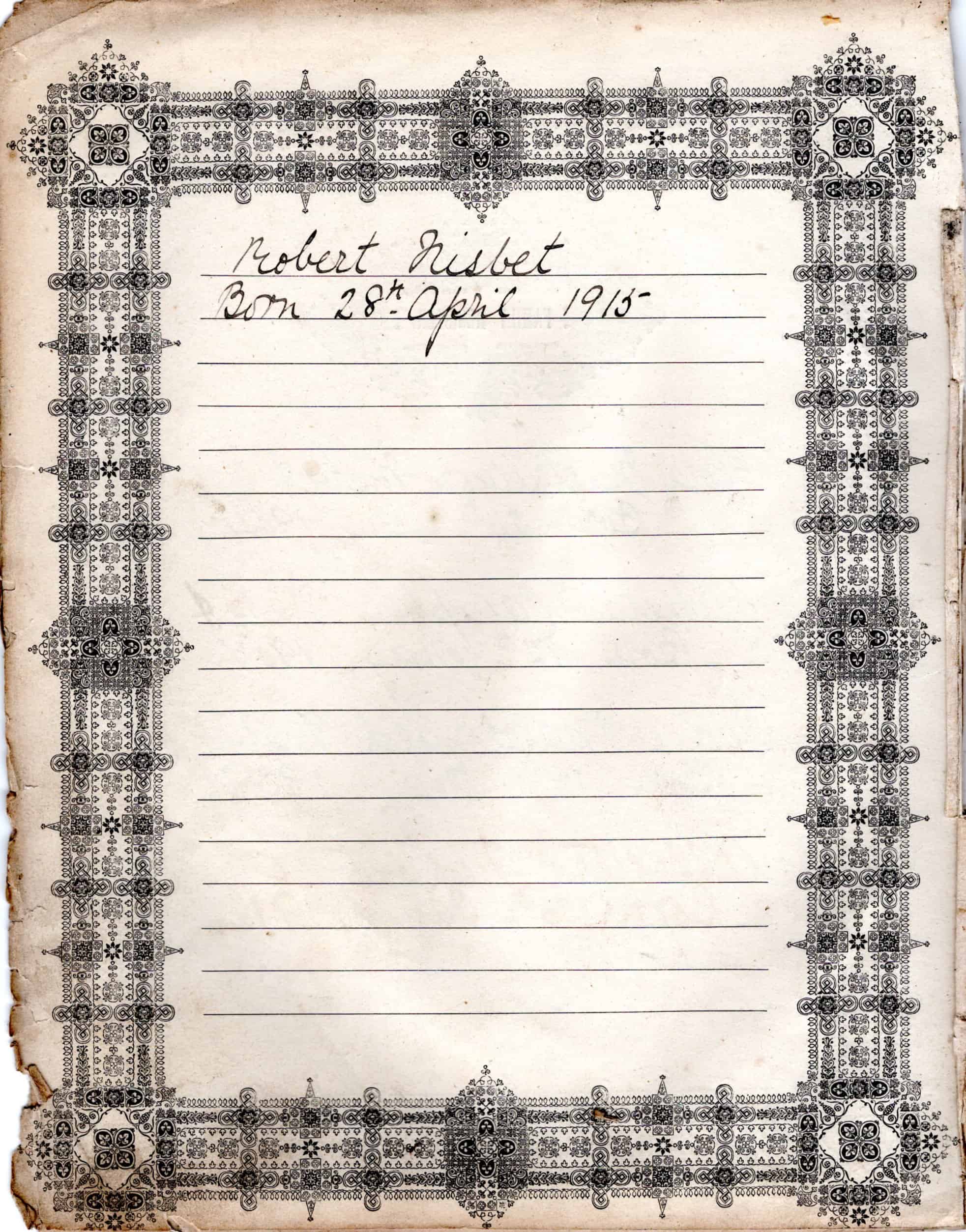
Large, leather-bound Brown’s Bible (1868) belonging to the Nisbet family of Heanish. Handwritten on the inside, on a Family Register page, are the names and dates of birth of the Nisbet children: Flora, Catherine, Joan, Allister and Robert.