


Map of Soroby cemetery
Hand-drawn map of the locations of all grave markers in the old sections of Soroby Cemetery digitised and printed onto hard board. Accompanied by a database of photographs and transcriptions of the headstones.


Map of Soroby cemetery
Hand-drawn map of the locations of all grave markers in the old sections of Soroby Cemetery digitised and printed onto hard board. Accompanied by a database of photographs and transcriptions of the headstones.
Land Grant map for Whycocomagh area of Cape Breton Island, Canada, 1950
OS-style map of the Whycocmagh area of Cape Breton Island, Nova Scotia, Canada, showing the boundaries of land granted to Scottish immigrants during the 19th century. Those known to belong to Tiree emmigrants have been marked by the donor. Index sheet 116; scale “one inch to forty chains”. Also included is a modern touring map of Cape Breton Island on which the donor has marked the Whycocomagh area for reference. See also a covering letter from the donor – 2012.102.2
Click here to view section of 2012.102.1 section
Map of west end of Tiree with updates c. 1934
Copy of an OS map from 1900, with handwritten annotations and updates by/for Cornaigmore H.G. and Heylipol Public schools in May/June 1934. Annotations include land use (probably Meadow, Heath and Agriculture) and notes regarding roads, crops, livestock, markets, horses and land tenure.
Map of township boundaries since at least 1990
Copy of Ordnance Survey map of Tiree (1:25,000) with township boundaries and compartment numbers hand-drawen in around 1990. On four sheets of A3.
Section of 1933 Tiree map indicating a golf course at Scarinish
Colour photocopy of a section of a 1933 Ordnance Survey map indicating the location of a golf course behind Scarinish. Original includes Baugh, The Reef, Crossapol, Heylipol, Balemartine, Mannal, Hynish, Balephuil, Barrapol and Moss.

OS map of Tiree annotated for road upgrades in the 1970s
Copy of OS map of Tiree (1:25,000) that has been annotated by hand to show which roads are to be upgraded in an extensive road improvement programme for the island. Probably in the 1970s. Locations of shops and road weight limits are included. Marked on the reverse “Tiree – for Bob Jones”.
OS 1:10,000 map of Vaul and Caoles 1976/7
Folded and damaged copy of 1976/7 1:10,000 Ordnance Survey map of Vaul, Salum, Caoles, Milton, Brock, Ruaig and Kirkapol showing contour lines, roads and paths, boundaries, townships and buildings, bridges and cattle grids, rivers and drains, sites of antiquities, vegetation and rock features. Duplicate archive item.
Map of areas occupied by the RAF on Tiree during WWII
Photocopy of a hand-drawn map of sites around the Reef, Baugh and Crossapol that were occupied by the RAF aerodrome and buildings for support personel, during WWII. Scale: 6 inches to 1 mile.
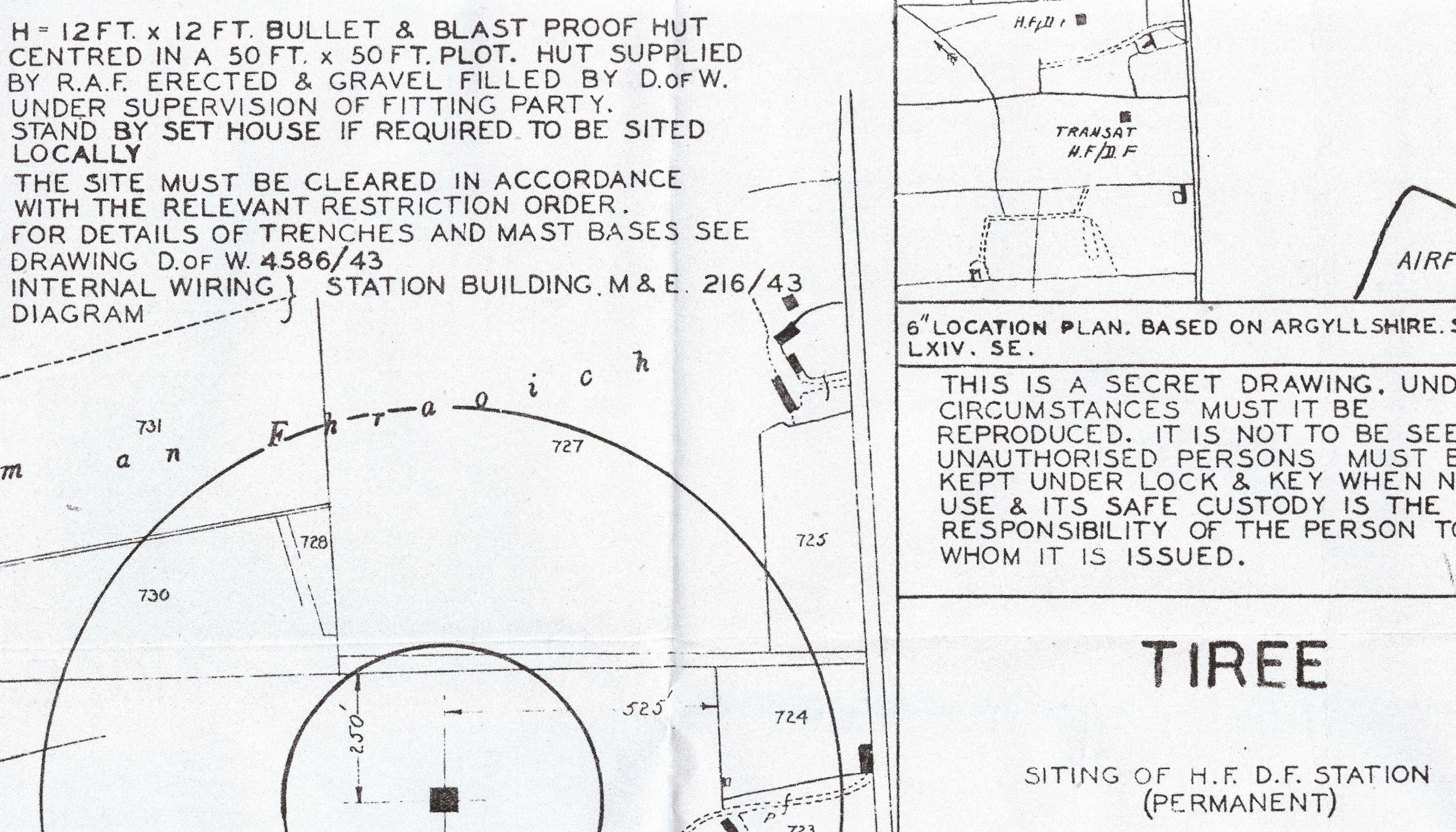
Map of siting of H.F./ D.F. Station at RAF Tiree, 1943
Photocopy of a “secret drawing” by the Air Ministry showing the location of a “bullet and blast proof hut” or H.F./D.F. Station to be built at Druim an Fhraoich, Kenovay. Marked `SECRET`, dated 21st July 1943. Scale 1:2500
Section of map showing location of the well at Dùn Mhòr broch, Vaul
Photocopied tracing of a section of map F19 – Ordnance Survey map sheet LXV.1, 1899 scale 1:2,5000, showing the location of the well `Tobar Duin Mhoir` at the broch at Vaul.
