Booklet titled `Isle of Tiree` edited by Mona MacDonald, with photocopy.
Guide to townships on Tiree, local advertising and map. Accession includes photocopy of same.

Booklet titled `Isle of Tiree` edited by Mona MacDonald, with photocopy.
Guide to townships on Tiree, local advertising and map. Accession includes photocopy of same.
Ordnance Survey map, sheet NM04NW, 1:10,000.
Map of Balephetrish, the Reef, Orisgal, Scarinish, Gott, Kirkapol and Vaul showing contour lines, roads and paths, boundaries, townships and buildings, bridges and cattle grids, rivers and drains, sites of antiquities, vegetation and rock features.
Map of part of Tiree showing the mains water supply in 1977.
Map showing the continuation of Phase II of the Tiree Rural Water Supply for Cornaig, Balephetrish, Gott, Kirkapol, Scarinish, Baugh, the Reef, Crossapol, Kenovay, Kilmoluaig and Balevullin, at a scale of 1:56,000 dated 1977.
Ordnance Survey map sheet LXIV.
Map of the north-west and central areas of Tiree from Greenhill in the west to Baugh in the east, at a scale of 6 inches to the mile (1:10,560).
Ordnance Survey map sheet LXIII & LXIV.
Map of the north-west and central areas of Tiree from Greenhill in the west to Baugh in the east, at a scale of 6 inches to the mile (1:10,560).
Ordnance Survey map sheet LXIII & LXIV.
Map of the north-west and central areas of Tiree from Greenhill in the west to Baugh in the east, at a scale of 6 inches to the mile (1:10,560).
Newspaper article about Hillcrest, Balephetrish.
Short article with photograph about the guest house at Hillcrest, Balephetrish, once run by Susan Bonar`s parents.
Audio cassette recording of Hugh Archie MacCallum interviewed by Maggie Campbell on 28/9/2002.
Hugh Archie MacCallum talks to Maggie Campbell in September 2002 about the Cornaigbeg crofts, the crofters’ names and patronymics; old and new methods of farming, seaweed and its uses, cattle shows; shebeens, shops, cobblers, the grocer’s horse-drawn van; the old schoolhouse at Cornaig and the United Free Church at Whitehouse; the evil eye; the shipwreck of the Malve during World War I. Eòghann Èairdsidh ’Ic Chaluim a’ bruidhinn ri Magaidh Chaimbeul anns an t-Sultain 2002 mu croitean Chòrnaig Bhige, ainmean agus sloinneadhan nan croitearan, dòighean sean agus ùr air croitearachd, feamainn, fèill cruidh, shebeens, bùthan, greasaichean, carbad bùtha air a tharraing le each, an t-seann sgoil Chòrnaig agus an Eaglais Shaor aig an Taigh Gheal, an droch shùil, am Malve a chaidh air na sgeirean aig àm a’ Cheud Chogadh.
Ordnance Survey map sheet LXIV.8.
Map of the Balephetrish area at a scale of 25 inches to the mile (1:2,500).
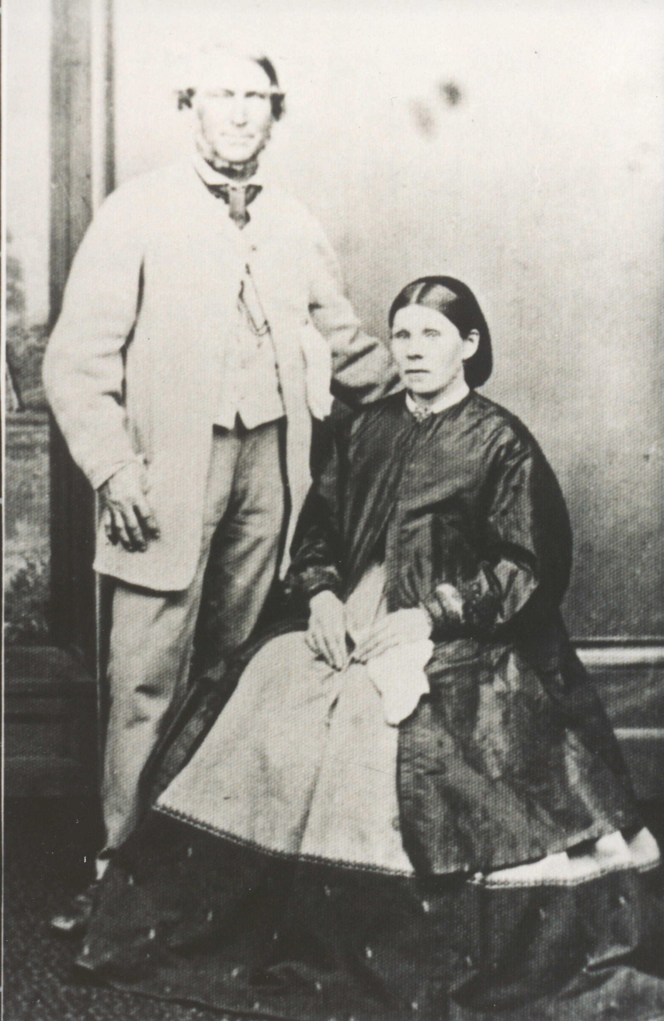
Black and white photograph of John MacEachern and Catherine Campbell.
John MacEachern (b. 1765) and his wife Catherine Campbell (b.1769) who were married in Balephetrish on 10/12/1788. Their son John was a blacksmith in Balephuil who emigrated to Australia on the `Brilliant` in 1837.