Photocopied extract from unknown publication about Free Church ministers serving on Tiree.
Information about the Free Church and its ministers on Tiree from 1853.

Photocopied extract from unknown publication about Free Church ministers serving on Tiree.
Information about the Free Church and its ministers on Tiree from 1853.
Ordnance Survey map, sheet NM04NW, 1:10,000.
Map of Balephetrish, the Reef, Orisgal, Scarinish, Gott, Kirkapol and Vaul showing contour lines, roads and paths, boundaries, townships and buildings, bridges and cattle grids, rivers and drains, sites of antiquities, vegetation and rock features.
Ordnance Survey map, sheet NM04NE, 1:10,000.
Map of Vaul, Salum, Caoles, Milton, Brock, Ruaig and Kirkapol showing contour lines, roads and paths, boundaries, townships and buildings, bridges and cattle grids, rivers and drains, sites of antiquities, vegetation and rock features.
Map of part of Tiree showing the mains water supply in 1977.
Map showing the continuation of Phase II of the Tiree Rural Water Supply for Cornaig, Balephetrish, Gott, Kirkapol, Scarinish, Baugh, the Reef, Crossapol, Kenovay, Kilmoluaig and Balevullin, at a scale of 1:56,000 dated 1977.
Ordnance Survey map sheet LXV.
Map of the eastern areas of Tiree from Baugh in the south to the Ringing Stone in the north, at a scale of 6 inches to the mile (1:10,560).
Ordnance Survey map sheet LXV & LXXIX.
Map of the eastern areas of Tiree from Baugh in the south to the Ringing Stone in the north, at a scale of 6 inches to the mile (1:10,560).
Laminated text from An Iodhlann`s 1997 exhibition.
Thirteen laminated sheets from An Iodhlann`s 1997 exhibition about the Reading Room, nicknames, Loch a` Riaghainn and the Vikings in Scarinish.
Jar containing charcoal fragments found at Loch a` Riaghainn, Kirkapol.

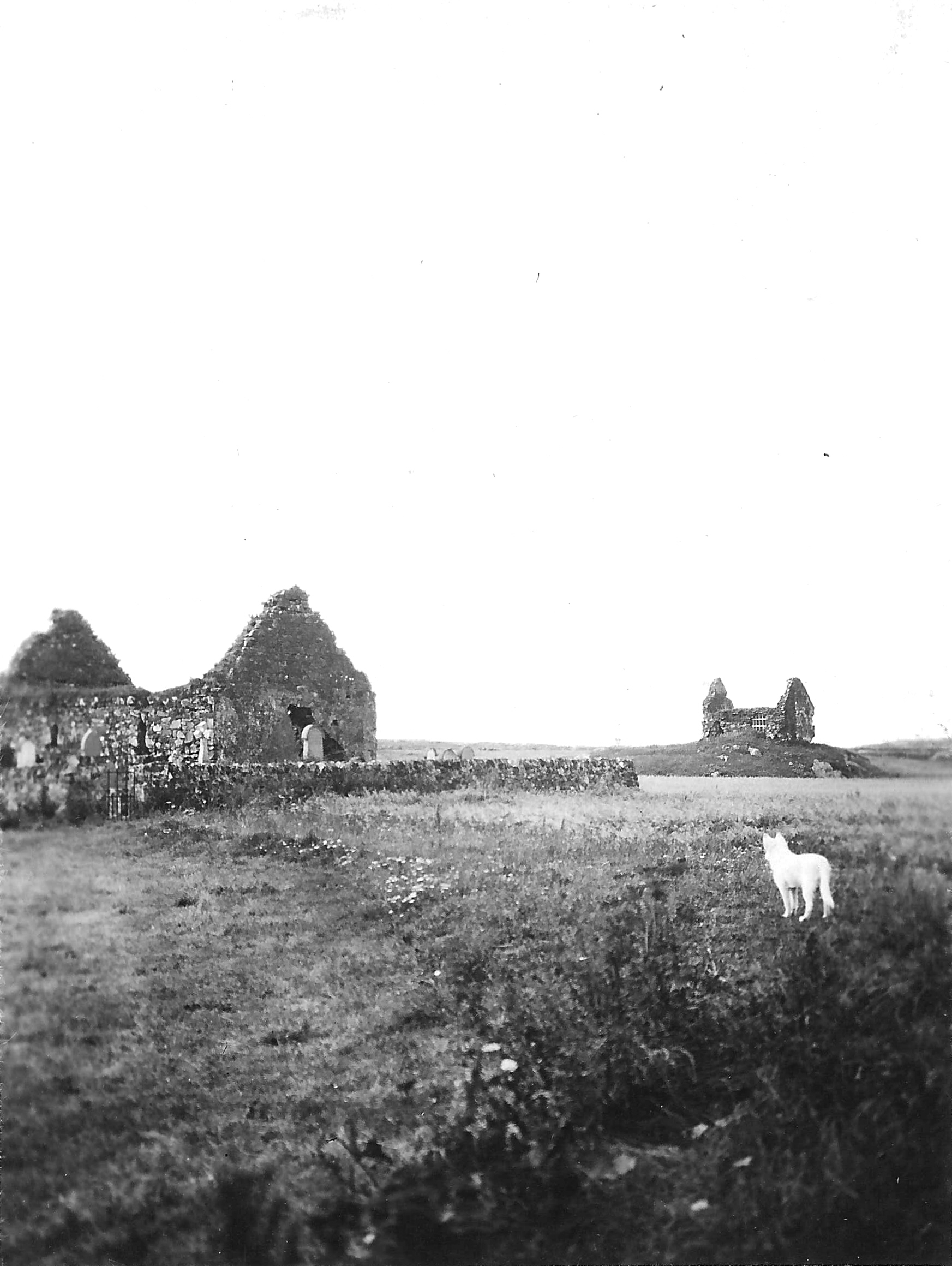
Black and white photograph of the Kirkapol Chapels in 1912.
The Kirkapol chapels with Lady Frances Balfour`s samoyed, Vaul, in the foreground, taken in 1912.
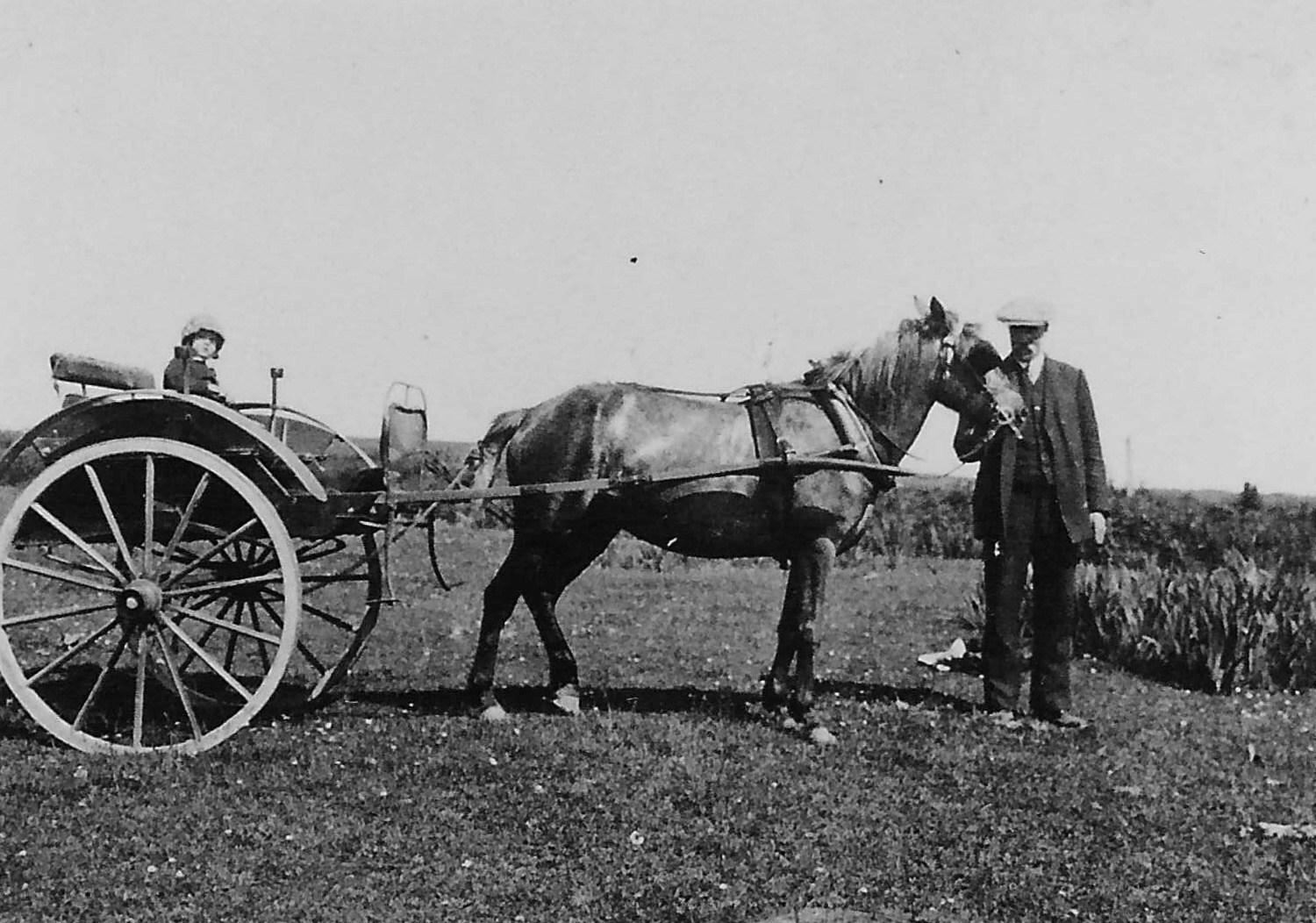
Black and white photograph of Elizabeth Milne with Calum Mor.
Elizabeth Milne, Lady Frances Balfour’s grand-daughter, with Calum Mòr from Lodge Farm in the 1910s.