


Ordnance Survey map sheet LXV & LXXIX.
Map of the eastern areas of Tiree from Baugh in the south to the Ringing Stone in the north, at a scale of 6 inches to the mile (1:10,560).

Ordnance Survey map sheet LXV & LXXIX.
Map of the eastern areas of Tiree from Baugh in the south to the Ringing Stone in the north, at a scale of 6 inches to the mile (1:10,560).
Map of the 1950s radar station on Beinn Gott.
Ground plan of the Rotorplan station, the UK`s Air Attack Early Warning System in the 1950s, on Beinn Gott, at a scale of 1:500. (See also 2002.103.1)
Colour photograph of the cyclists in the Glasgow-Tiree Cycle Run in aid of hall funds.
Cyclists from the Glasgow-Tiree Cycle Run making their way up the pier on 3/6/2002, with the `Clansman` in the background.

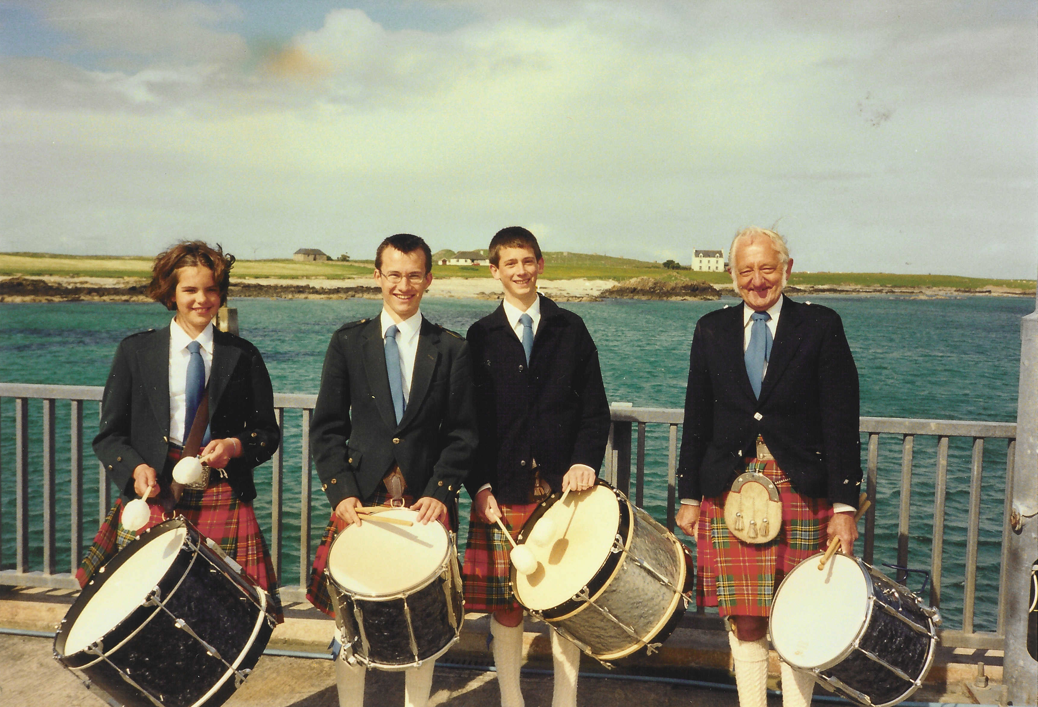
Colour photograph of the Drum Corps of Tiree Pipe Band on 3/6/2002.
The Drum Corps of Tiree Pipe Band waiting at the pier to greet the cyclists from the Glasgow-Tiree Cycle Run on 3/6/2002. L-R: Sophie Isaacson, Kenovay; Andrew Findlater, Scarinish; Michael Holliday, Baugh; Gordon Connell, Crossapol.
Ordnance Survey map sheet LXV.9.
Map of the Gott area at a scale of 25 inches to the mile (1:2,500).
Ordnance Survey map sheet LXV.10.
Map of the Gott Bay area at a scale of 25 inches to the mile (1:2,500).
Black and white photograph of Gott Bay pier.
Gott Bay pier, probably taken in the early 20th century.

Black and white photograph of the `Clydesdale` at Tiree pier.
The old `Clydesdale` at Gott Bay pier during World War II. (Photograph from Mike Hughes in Filing Cabinet 2 drawer 1)

Black and white photograph of Gott Bay pier during World War II.
Photograph of a dinghy with passengers taken from under the pier during World War II. (Photograph from Mike Hughes in Filing Cabinet 2 drawer 1)

Black and white photograph of servicemen at Gott Bay pier during World War II.
Group of airmen and others at Gott Bay pier during World War II. (Photograph from Mike Hughes in Filing Cabinet 2 drawer 1)
