Map of RAF Tiree sites in Crossapol in 1945.
RAF Tiree sites 1-9 in Crossapol including WAAF Sites 1 and 2, Sick Quarters and the Communal Site, scale 1:2,500.

Map of RAF Tiree sites in Crossapol in 1945.
RAF Tiree sites 1-9 in Crossapol including WAAF Sites 1 and 2, Sick Quarters and the Communal Site, scale 1:2,500.
Map of the layout of Tiree Aerodrome dated 1951.
Layout of Tiree Aerodrome showing runways, buildings and their uses, at a scale of 1:2,500.
Ordnance Survey map sheet LXXVIII.3 with RAF sites superimposed.
RAF Tiree sites 1, 2, 4, 8 and 9 in Crosapol including WAAF Sites 1 and 2, Sick Quarters and the Communal Site, scale 1:2,500.
Map of Tiree Aerodrome dated 1948.
Layout of Tiree Aerodrome dated 1948 with comments in pencil, one dated 1950, scale 1:2,500.
Map of Scotland with location of Royal Observer Corps posts dated 1959.
Location plan of Royal Observer Corps posts throughout Scotalnd dated 1959, scale1:625,000.
Map of Tiree Aerodrome dated 1953.
Map of Tiree Aerodrome titled Tiree Lettings Location Plan dated November 1953 showing cattle grids at a scale of 1:10,560.
Map of the water pipeline and electric cable between Loch a` Phuill and Crossapol.
Plan showing part of the water pipeline and electric cable route between Loch a` Phuill and Crossapol dated 1951, scale 1:10,560.
Black and white photograph of an airborne Halifax.
A Halifax aircraft from RAF 518 Squadron airborne over Tiree during World War II. (Photograph from Mike Hughes in Filing Cabinet 2 drawer 1)

Black and white photograph of an RAF crew based on Tiree during World War II.
RAF crew from 518 Squadron photographed during World War II in front of a Halifax aircraft. L-R: Harry Coxhead (W/Op); Bill Piree (Flt Eng.); Jack Masters (Navigator); ? Jamieson (2nd pilot); Paddy Wilson (Pilot); Bill Stafford (W/Op, Australian): ? Joudray (W/Op, Canadian); Sgt Fred Gee (Met. Air Obsr). (Photograph from Mike Hughes in Filing Cabinet 2 drawer 1)

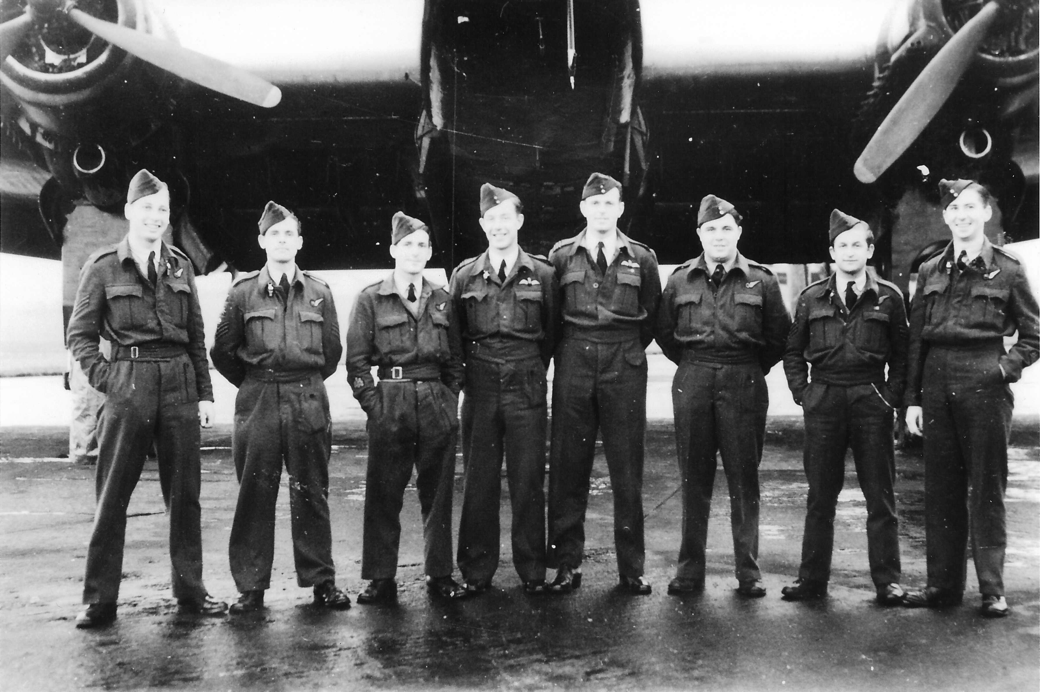
Black and white photograph of an RAF crew based on Tiree during World War II.
RAF crew from 518 Squadron under a Halifax aircraft during World War II. (Photograph from Mike Hughes in Filing Cabinet 2 drawer 1)