


Ordnance Survey map of Coll, sheet XXXVII, 1881
Map of Coll: Arinagour and northeast, at a scale of 6 inches to the mile (1:10,560), surveyed in 1878.

Ordnance Survey map of Coll, sheet XXXVII, 1881
Map of Coll: Arinagour and northeast, at a scale of 6 inches to the mile (1:10,560), surveyed in 1878.
Ordnance Survey map of Coll, sheet XXXVI, 1881
Map of Coll: Arinagour Farm to Hogh Bay and Gallanach, at a scale of 6 inches to the mile (1:10,560), surveyed in 1878.
Ordnance Survey Map of Coll, sheet XLIX, 1881
Map of Coll: Caoles and Gunna, at a scale of 6 inches to the mile (1:10,560), surveyed in 1878.
Ordnance Survey map of Coll, sheet L, 1881
Map of Coll: Crossapol Bay to Fiskarg, at a scale of 6 inches to the mile (1:10,560), surveyed in 1878.
Ordnance Survey map of Coll, sheet XXII, 1881
Map of Coll: Torastan to the Cairns of Coll, at a scale of 6 inches to the mile (1:10,560), surveyed in 1878.
Newspaper article about the Balephuil fishing disaster, 1856
Photocopy of a newspaper article from the Glasgow Herald, July 1856 (and typed transcript by donor), about the loss of nine fishermen in a storm off Balephuil in 1856. Thirty-nine men set off fishing in six boats but were overtaken by a gale. Thirty out of thirty-three men survived in three boats that made it to Islay. All six were lost from one boat that came ashore on Coll.
Click here to view 2014.95.1
Annotated OS map of Coll and Tiree, 1947-1951
1947 Ordnance Survey map of Coll and Tiree used by David Renfrew (Glasgow) during a visit to Tiree with his girlfriend and her parents in 1951. The map is annoted with straight lines and crosses for “ship 1”, “ship 2” and “ship 3” across the sea between Tiree, Coll and the Treshnish Isles, the purpose of which are unknown.
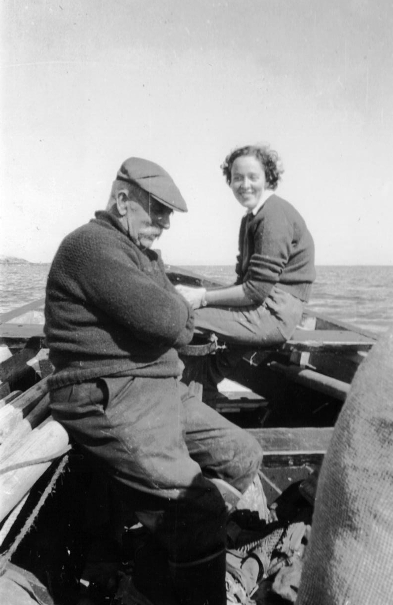
Photograph of the Coll ferryman and passengers around 1950.
Black & white photograph of the Coll ferryman, Mr MacDonald, transporting two passengers to/from the ferry at Coll around 1950. (original stored on CD in filing cabinet 10 drawer 1)

Photograph of the Coll ferryman, MacDonald, around 1950
Black & white photograph of the Coll ferryman, Mr MacDonald, transporting a passenger to/from the ferry at Coll around 1950. The woman is probably Mrs Michael Watson. (original stored on CD in filing cabinet 10 drawer 1)
Book `The Sea Kingdom – Coll and Tiree` by the Hebridean Whale and Dolphin Trust, 2003
Small softback marine heritage guide about the history and natural history of Coll and Tiree by the Hebridean Whale and Dolphin Trust, 2003.